The Map of Israel: Understanding Its Size, Scale, and Unique Borders
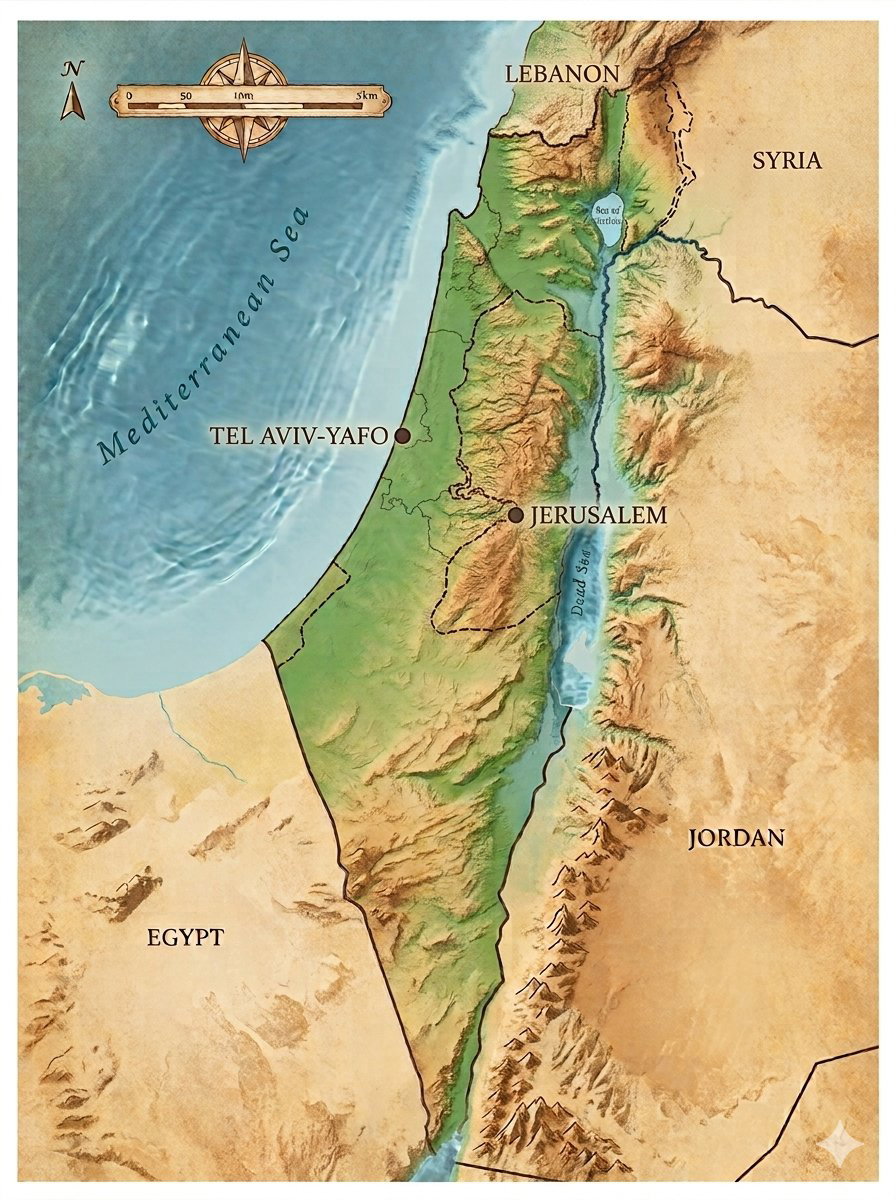
Israel is a country that constantly dominates global headlines, yet many people are surprised to learn just how small it actually is. Positioned at the literal meeting point of Europe, Asia, and Africa, this compact nation navigates a highly complex geopolitical landscape within an incredibly tiny physical footprint.To understand Israel is to understand its geography—a place where world-altering history and diverse landscapes are packed into an area smaller than many global lakes.
1. Putting Israel's Size into PerspectiveIsrael's total area stands at approximately 8,519 square miles. To grasp just how compact this is, it helps to look at global benchmarks:
- Smaller than Lake Michigan: Israel’s entire landmass is less than half the size of Lake Michigan. In fact, you could fit the entire country inside the lake more than two and a half times.
- Comparable to Global Regions: It is roughly the same size as the European nation of Slovenia, the Mediterranean island of Sicily (Italy), or the US state of New Jersey.
- A Short Drive from End to End: While the country is only 263 miles long in a straight line, the actual road trip from the snowy slopes of Mount Hermon in the far north to the desert beaches at the southern border spans roughly 340 miles—a distance people can easily drive in under 7 hours.
- Unbelievably Narrow: At its narrowest point (the "narrow waist" near Netanya), Israel is a mere 9 miles wide, meaning people could jog across the width of the country in about 1.5 hours. At its absolute widest, it spans just 70 miles.
2. Navigating the Land BordersOutside of its coastlines, Israel shares its boundaries with four neighboring nations alongside unique internal administrative territories:
- Egypt (Southwest): A formal, peaceful border established by the historic 1979 Peace Treaty. It stands as Israel's longest continuous border with a neighboring nation.
- Jordan (East): A peaceful border established in 1994, running along the Jordan River, the Dead Sea, and down to the Red Sea.
- Lebanon (North): Not an official agreed-upon border, but rather a UN-demarcated armistice line known as the "Blue Line."
- Syria (Northeast): A ceasefire line established in 1974. Israel officially applied its law, jurisdiction, and administration to the Golan Heights in 1981, making this volcanic plateau an integral part of the country's northern landscape and defense.
- The West Bank: An area with complex geopolitical status, where internal boundaries and security control are uniquely divided based on historical accords.
3. Gateways to the World: The Maritime BordersWhile small in land, Israel holds strategic maritime assets that connect it directly to global trade and resource independence:
- The Mediterranean Sea (West): A primary 121-mile coastline that serves as Israel's main trade gateway to the West. This area is also home to major offshore natural gas fields that power the nation.
- The Red Sea (South): A tiny but crucial 7-mile coastline in Eilat, giving people and cargo direct maritime access to Africa, Asia, and the Far East without needing to transit the Suez Canal.
- The Dead Sea (East): A unique landlocked maritime border shared with Jordan, famous worldwide for its hypersaline waters and for being the lowest point on Earth.
Final ThoughtsThe defining characteristic of Israel's geography is its extreme density. Unlike nations with vast, sweeping distances, Israel allows people to experience an alpine mountain peak in the Golan Heights, a bustling beachfront tech metropolis in Tel Aviv, a stark desert crater in the Negev, and a desert coral reef in Eilat—all within a single day's road trip. It remains one of the most geographically diverse, compact, and scrutinized strips of land on the planet.
🗺️ Want to experience these incredible transitions yourself?
If you are planning to visit Israel and want to see the dramatic shifts from the northern mountains to the southern deserts firsthand, check out the custom itineraries offered by Asher Drimmer Tours to maximize your journey across this unique landscape.
